

'Pakistan will have to adapt to floods as the new normal'
Published On 12 Sep, 2025
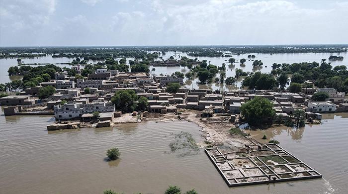
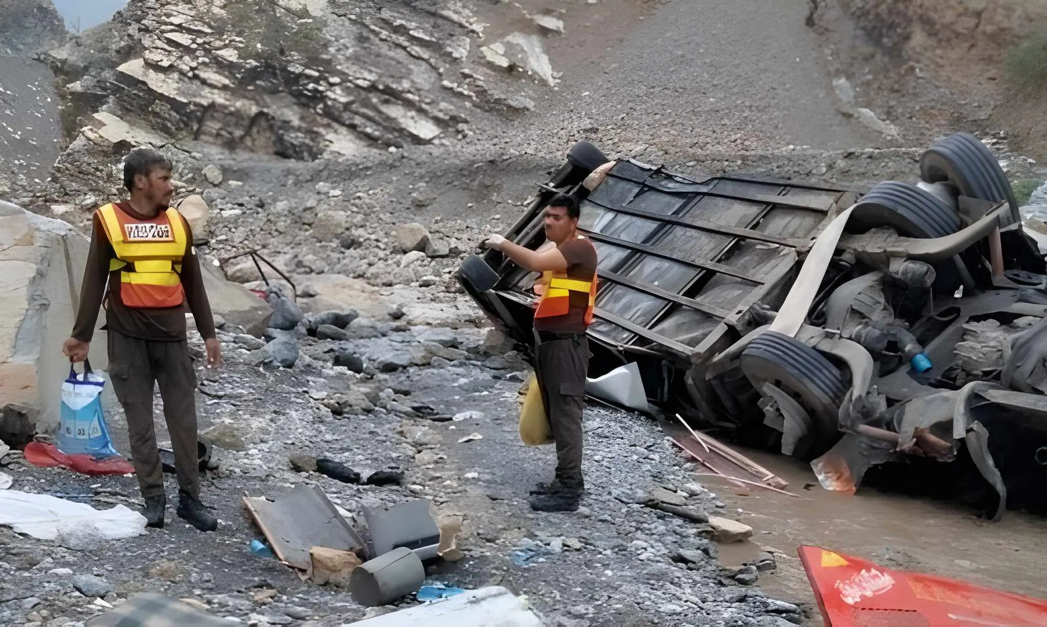
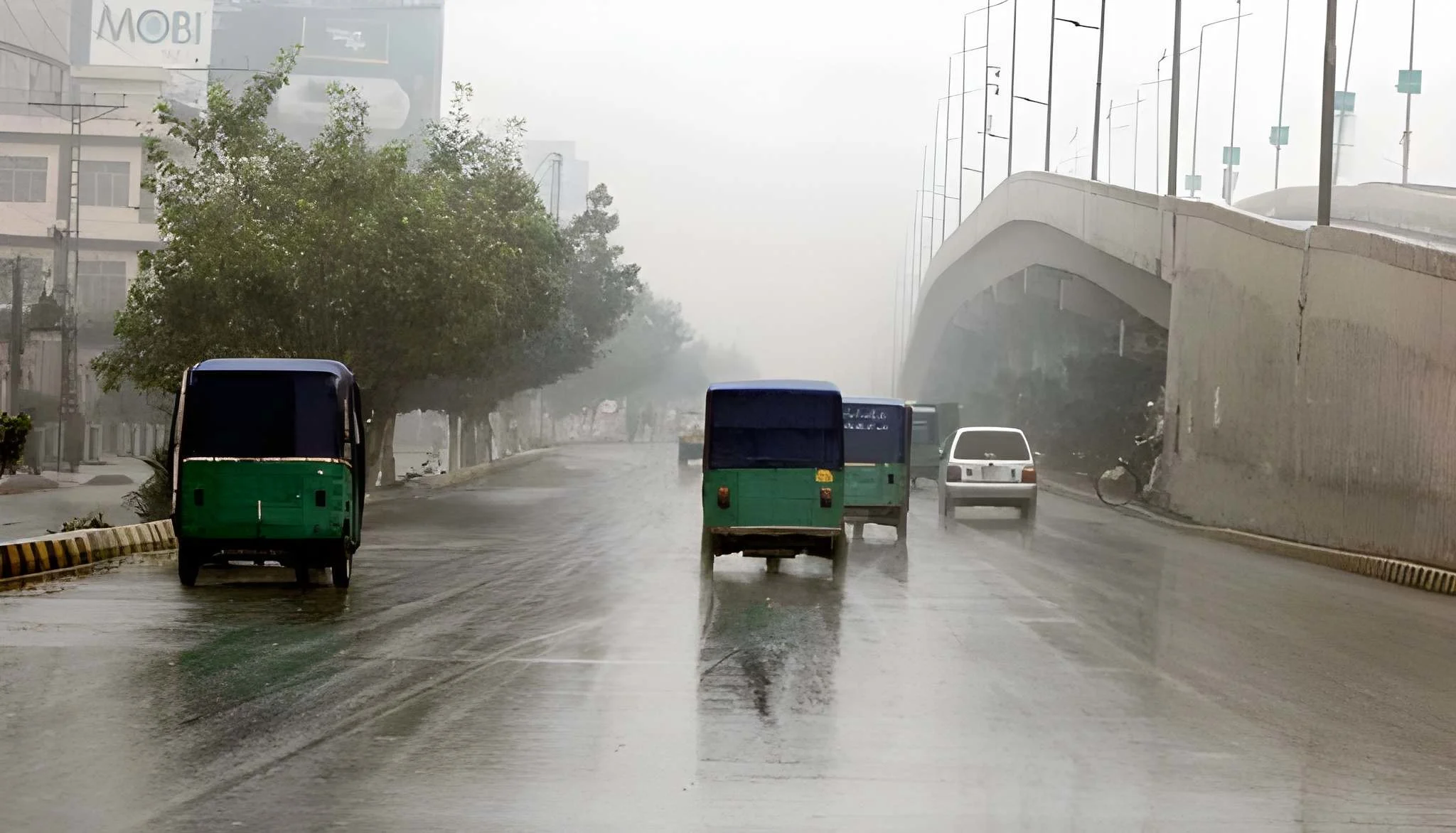
With millions displaced and close to a thousand people dead, the Pakistan floods that have been ongoing since June are worryingly reminiscent of the floods that devastated the country in 2022. As the country fights to keep its head above the rising floodwaters, many questions abound. Could the damage so far have been contained? How has climate change contributed? Has India’s release of floodwater — which it had warned about — exacerbated the loss and damage of its lower riparian neighbour? Have the floods been down to bad governance, or a lack of preparedness?
To understand these matters, Dialogue Earth spoke to Muhammad Ehsan Leghari, an expert on water resource management and member for the Sindh province at the Pakistani water regulator, the Indus River System Authority. He discussed the factors that have contributed to the unprecedented floods in Pakistan, what has and hasn’t worked for flood control, and how the country can manage future floods effectively. This conversation has been edited for length and clarity.
What are the main natural and human-made factors that cause recurrent floods along the Indus River and its tributaries, particularly the massive inflows in the Punjab rivers?
As the geographer Gilbert F White noted in 1942, “Floods are ‘acts of God’, but flood losses are largely acts of man”. Human choices in building and managing floodplains can turn natural hazards into disasters. The world, including Pakistan, has been slow to adopt behavioural adjustments alongside engineering, often implementing solutions poorly or unnecessarily.
There are some key factors, generally, regarding the exacerbation of flood impacts. Weak governance turns emergencies into disasters, as seen in recent deaths from floods in Khyber Pakhtunkhwa and other parts of Pakistan. Lack of rational spatial or land-use planning exacerbates urban and riverine flooding. Top-down planning ignores real issues and experiences for most Pakistanis. Political and bureaucratic elites prioritise “brick-and-mortar” development that increases flood and hazard impacts.
Intense monsoons with 200 to 300mm rainfall that had been forecasted, glacial melt and storms, predicted amid northern heatwaves, are natural factors that caused the floods. But human-made factors cannot be ignored: deforestation increases runoff, and urbanisation and encroachments block natural flows. Similarly, the Ravi Urban Development Authority’s paving of floodplains along the Ravi River in Punjab turned absorbent areas into concrete, inviting devastation by turning them into river paths.
Reports like Pakistan’s 2025 Monsoon Prediction, the National Adaptation Plan and the updated Climate Change Policy highlight reduced river capacity from bridges and encroachments. They’ve urged resilience through wetlands and habitat restoration, but have been ignored.
The 2025 inflows have been a result of exceptional upstream rains, Himalayan melt, and India’s dam releases amid heavy rainfall that overwhelmed Punjab’s flatlands, displacing over 2 million people and impacting more 3.6 million, with millions more at risk as waters reach Sindh. This exposes systemic issues: encroached plains displace water onto communities, costing billions. Enforced zoning is needed to break the cycle.
How do glacial melt and changing monsoon patterns contribute to flooding in Pakistan?
They drive unpredictability. Accelerated melting in the Himalayan, Hindu Kush and Karakoram mountain ranges due to warming heightens during heatwaves, synchronising with erratic, concentrated rains that overload the Chenab and Sutlej rivers in Punjab. The province faces riverine overflows, while Khyber Pakhtunkhwa and Sindh see flash and urban floods.
With Pakistan contributing to less than 1% of global emissions, it’s an unjust hit when the country suffers from climate extremes, and in turn, USD 2 billion in losses. Pakistan will have to adapt to this new normal via basin monitoring, integrating it into development paradigms.
How effective are barrages, embankments and canals in managing floods? Do they worsen downstream flooding?
Controlled systems often increase downstream floods and droughts. Punjab mostly managed its headworks (structures at waterway diversion points) and barrages well during 2025 peaks, ensuring safely passing overflows. But Head Panjnad, a barrage where five rivers converge, faced aggressive flood waves, as forecasts by the Flood Forecasting Division had forewarned us. Punjab has rehabilitated most of its barrages; Sindh is upgrading its Guddu and Sukkur barrages.
However, these hydraulic structures can cause bottlenecks, blocking river paths and causing breaches, shifting burdens without adequate warning. Our infrastructure is old and inadequate, fostering a false sense of security for nearby developments. The solution is to shift strategy: live with floods, remove bottlenecks, let rivers flow and nourish floodplains. In addition, we must combine nature-based solutions – such as restoring floodplains — and controlling overflows with modern technology like automated barrage gates and AI forecasting.
What role does silt and sediment buildup in rivers and barrages play in increasing flood risks?
They raise riverbeds. Sediment buildup has elevated the River Indus riverbed, reducing the river’s flood handling capacity by 17.75%. Research has shown that over a 24-year period, this issue, combined with diminished water flow, has decreased the river’s capacity to manage high water levels by nearly half. Without management, sediment buildup causes spills, erosion, breaches and waterlogging.
It’s a cyclical issue: earlier deforestation upstream caused more soil to wash into the river, and the continued failure to manage this sediment has made recent floods, such as those in 2025, much worse, costing billions and impacting thousands of people. We need basin-wide sediment strategies such as integrated watershed management for the Indus, involving India and Afghanistan.
How is climate change expected to alter the intensity and frequency of floods in the Indus River basin over the next 20–30 years?
Climate change will increase the intensity and frequency of floods in the basin over the next few decades. This will mainly be caused by more intense monsoon rains, surging glacier melt and rising sea levels that block drainage in Sindh. It will lead to a new normal of more severe flooding, such as that seen in the 2010, 2022 and 2025 events. That means increased losses and vulnerability, with models predicting even more economic and human damage. Research from the World Weather Attribution supports the overall trend of rising flood vulnerability.
To counter this, a combination of nature-based solutions like restoring wetlands to help absorb floodwaters and engineering solutions are needed, along with improved governance across the entire river basin.